
![]()
Nevada is almost entirely within the Basin and Range Province, and is broken up by many north-south mountain ranges. Most of these ranges have inland-draining (unconnected to the ocean by waterways) valleys between them, which belies the image portrayed by the term Great Basin.
Much of the northern part of the state is within the Great Basin Desert, a mild desert that experiences hot temperatures in the summer and sub-freezing temperatures in the winter. Occasionally, moisture from the Arizona Monsoon will cause summer thunderstorms; Pacific storms may blanket the area with snow. The state's highest recorded temperature was 125 °F (52 °C) in Laughlin (elevation of 605 feet) on June 29, 1994.
The Humboldt River crosses from east to west across the northern part of the state, draining into the Humboldt Sink near Lovelock. Several rivers drain from the Sierra Nevada eastward, including the Walker, Truckee and Carson rivers.
The mountain ranges, some of which have peaks above 13,000 feet (4,000 m), harbor lush forests high above desert plains, creating sky islands for endemic species. The valleys are often no lower in elevation than 3,000 feet (900 m).
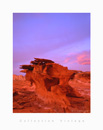
The southern third of the state, where the Las Vegas area is situated, is within the Mojave Desert. The area receives less rain in the winter but is closer to the Arizona Monsoon in the summer. The terrain is also lower, mostly below 4,000 feet (1,200 m), creating conditions for hot summer days and cool to chilly winter nights due to inversion.
 Nevada and California have by far the longest diagonal line (in respect
to the cardinal directions) as a state boundary at just over 400 miles
(640 km). This line begins in Lake Tahoe nearly 4 miles (6 km) offshore
(in the direction of the boundary), and continues to the Colorado River
where the Nevada, California, and Arizona boundaries merge 12 miles
(19 km) southwest of the Laughlin Bridge.
Nevada and California have by far the longest diagonal line (in respect
to the cardinal directions) as a state boundary at just over 400 miles
(640 km). This line begins in Lake Tahoe nearly 4 miles (6 km) offshore
(in the direction of the boundary), and continues to the Colorado River
where the Nevada, California, and Arizona boundaries merge 12 miles
(19 km) southwest of the Laughlin Bridge.
The largest mountain range in the southern portion of the state is the Spring Mountain Range, just west of Las Vegas. The state's lowest point is along the Colorado River, south of Laughlin. (Source Wikipedia)
![]()
© 1998-2026 - C. Cassegrain Photograph - All rights reserved v.01 - Mobile : +33 6 71 26 04 76 |